Precision 3D Terrestrial LASER Scanning
Discover the pinnacle of precision with
Setch
Design’s 3D terrestrial laser scanning services in Townsville, QLD and surrounding areas. Our cutting-edge laser scanners are your gateway to unparalleled accuracy, making it a game-changer for various industries, including construction and heavy engineering projects.
3D Terrestrial Laser Scanning
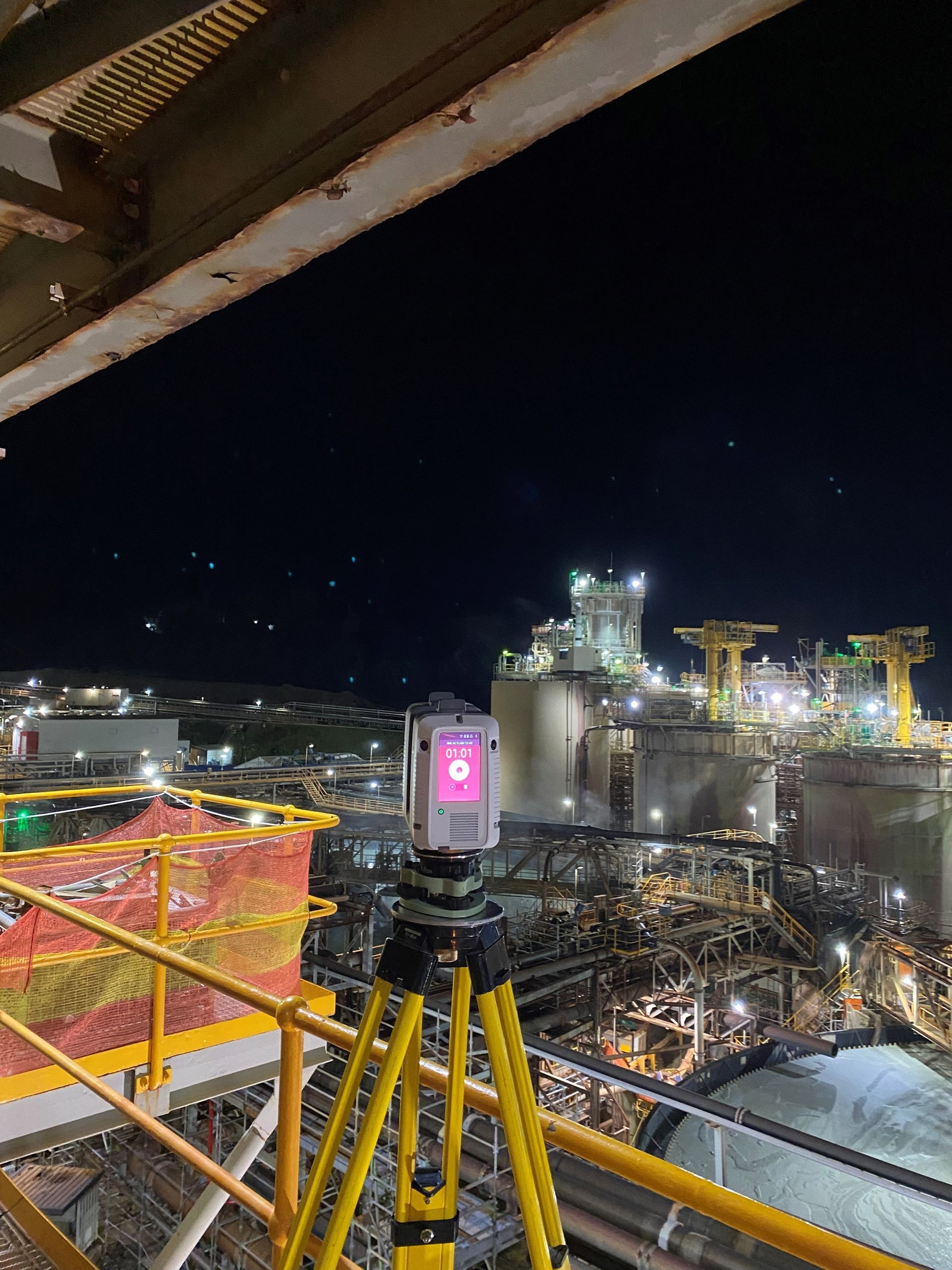
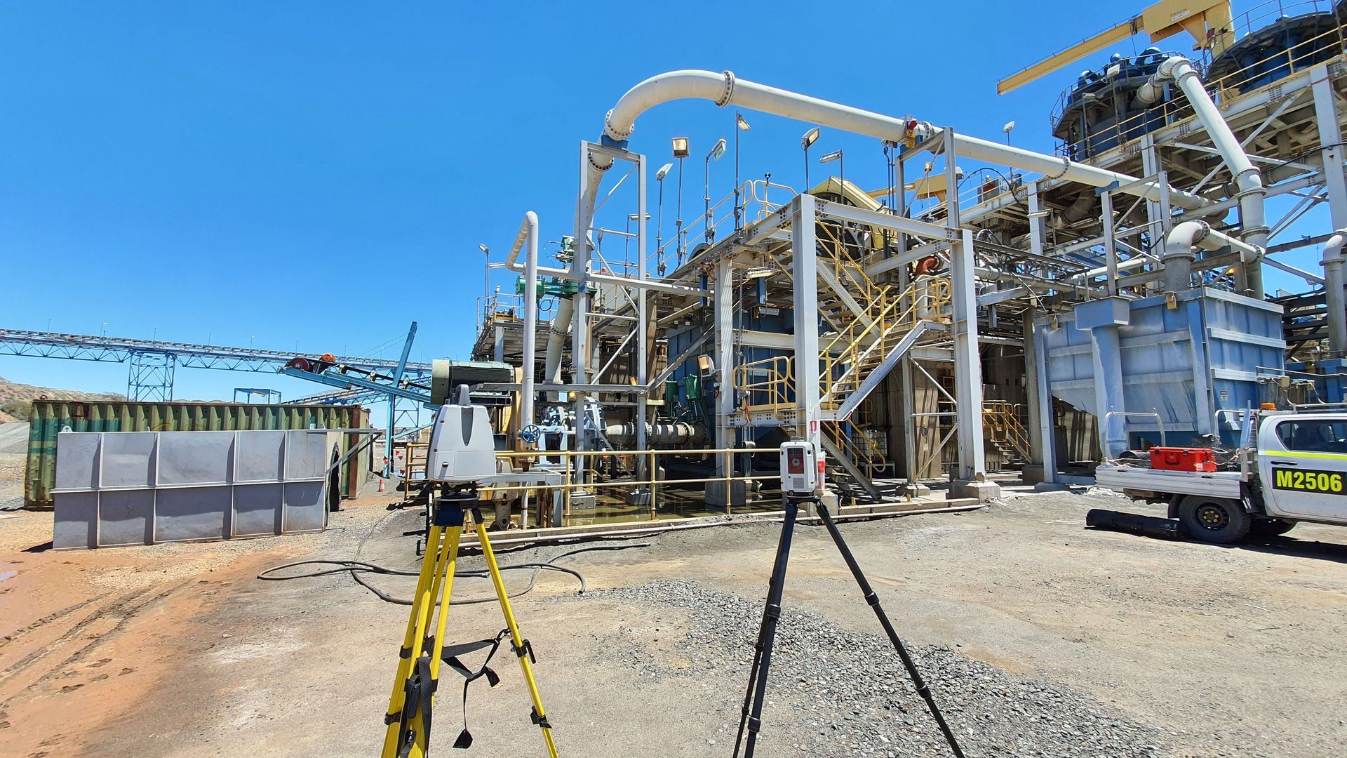
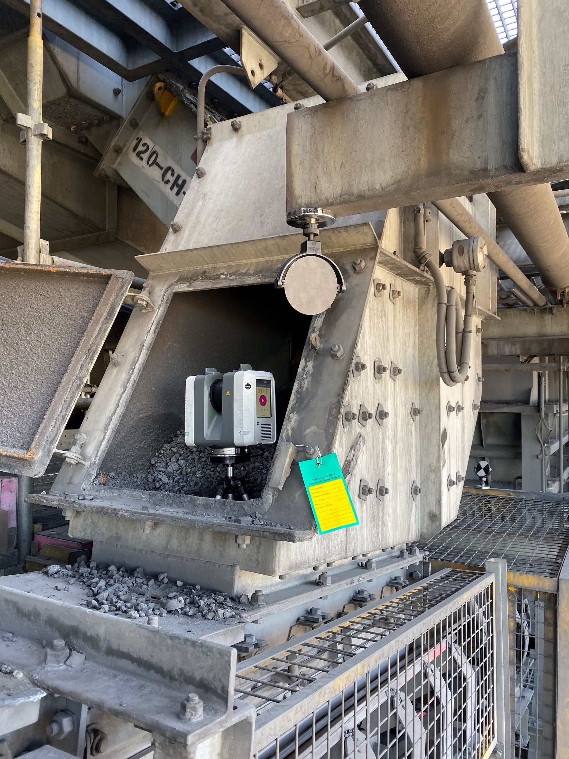
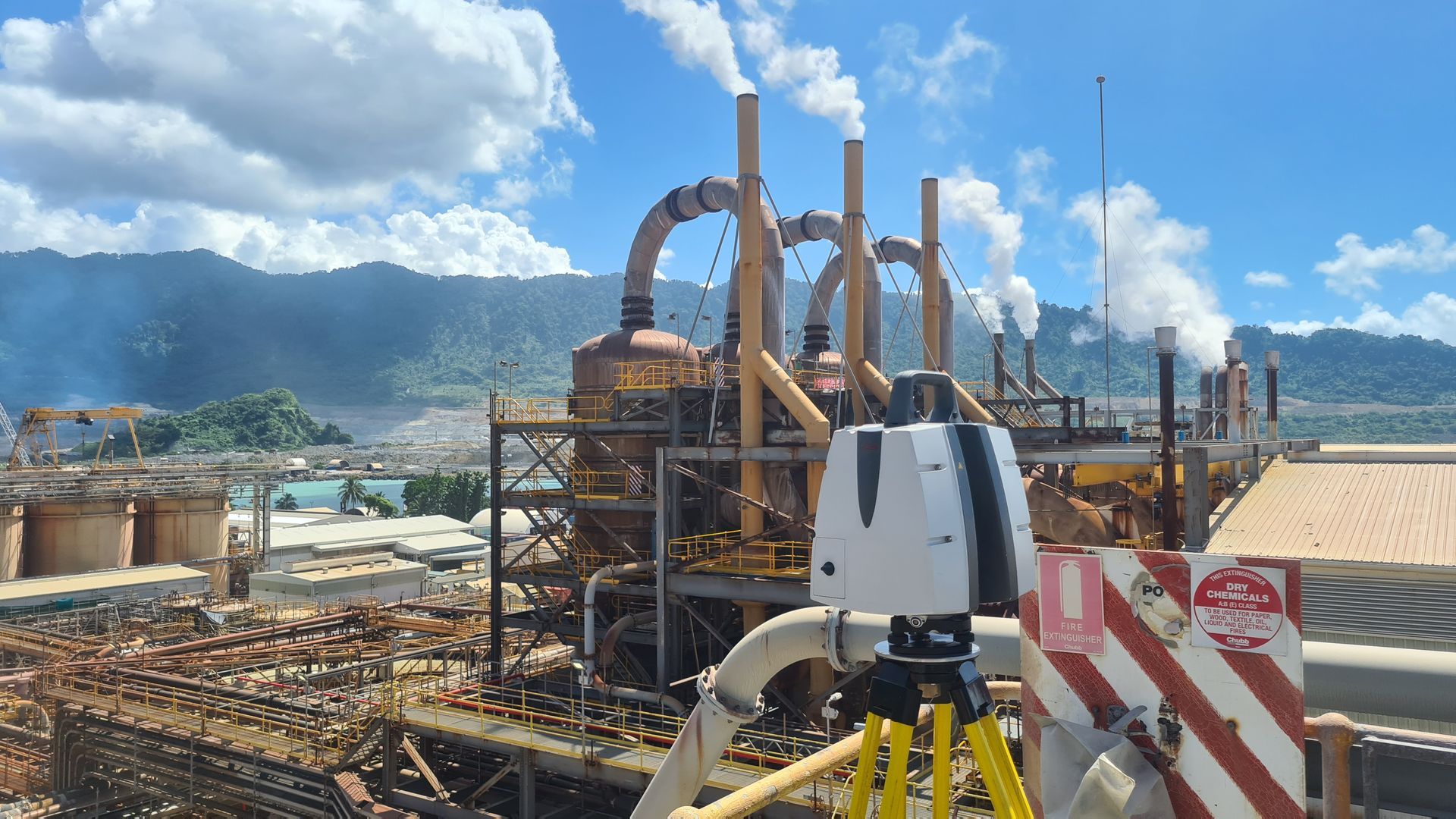
SETCH Designs’ tripod-based Laser Scanners are used in all areas of the Engineering Services we offer. The process includes, setting up a tripod and scanning in multiple locations to progressively build a 3D picture of the scope. While on site, we perform a preliminary registration, aligning the scans together, to ensure we have covered the scope and review with our clients before leaving site. We have a range of tripods and accessories, including some of our own creation, that allow for the scanners to be raised high above the ground, inverted into pits and attached to various equipment where access is challenging.
Our Scanners
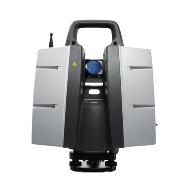
Leica P40
The Leica P40 delivers high quality 3D data and High Dynamic Range (HDR) imaging at a scan rate of 1 million points per second with a range of up to 270m. The key features are excellent, low noise, survey-grade dual-axis compensation, capability to traverse and capability to acquire survey targets. This enables us to align our scan data coordinate system with existing site datums.
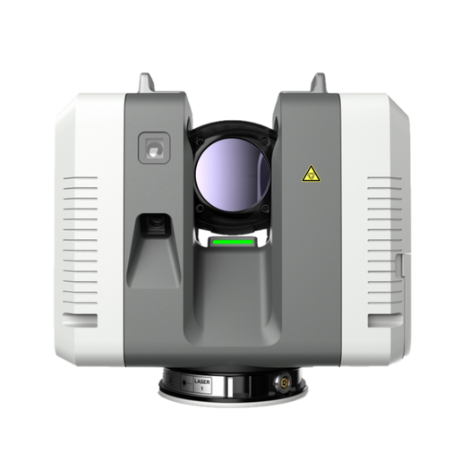
Leica RTC360
The Leica RTC360 delivers high quality 3D and High Dynamic Range (HDR) imaging at a scan rate of 2 million points per second with a range of up to 130m. A full colour scan completes in under two minutes and enables large areas of plant to be scanned quickly.
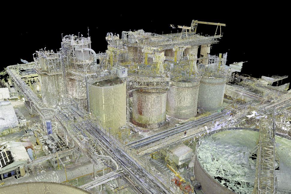
Terrestrial Laser Scanning Applications
Setch Design’s 3D terrestrial laser scanning services find applications in a wide range of scenarios. We excel at acquiring data for construction projects, providing accurate maps of boundaries and elevations. Additionally, our scanning technology is ideal for capturing existing structures ensuring precision in fittings and renovations.
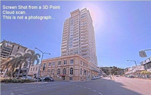
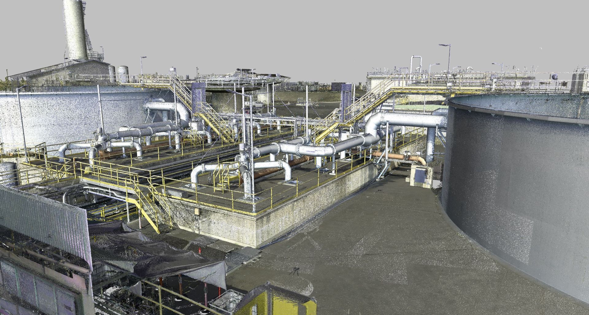
Terrestrial Laser Scanning Example
3D Laser Scanning Benefits
- ‘Unmeasurable’ plant and equipment is no longer a roadblock.
- We can accurately measure and model with a considerable time saving compared to conventional methods.
- Dimensional data is collected more safely without the requirement to isolate or scaffold sections of the plant.
- Data collection is completed without interruption to the operation of the plant.
- Newly fabricated components or piping can be dimensionally checked when completed and before a shutdown to ensure a correct fit within the plant.
- The number of field welds can be confidently reduced with the added benefit of reducing shutdown duration.
- Time, safety, accuracy, efficiency, confidence
For precision terrestrial laser scanning solutions, give us a call at (07) 4725 3544.