Aerial Lidar and Mapping Excellence
What is Aerial LiDAR and Mapping?
Setch
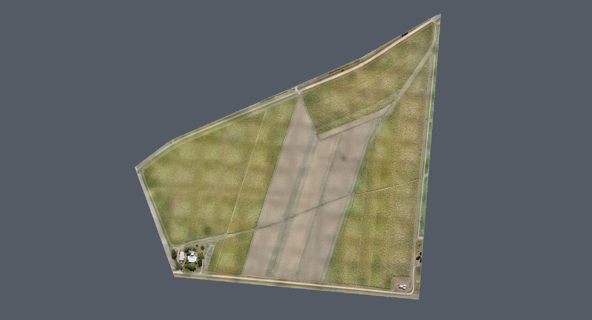
Design redefines precision through our aerial LiDAR and mapping services in Townsville, QLD, and surrounding areas of Queensland. UAV (Unmanned Aerial Vehicle) technology is rapidly advancing with new technologies providing a fast and effective solution to capture accurate, colourised and highly detailed data on a large scale. This technology also provides an aerial view and access to terrain inaccessible or impractical for terrestrial scanning. Applications included outdoor stockpile volumes, roof inspections, geographic mapping, scanning pipelines, drainage surveying and agricultural crop mapping.
Our Aerial Equipment
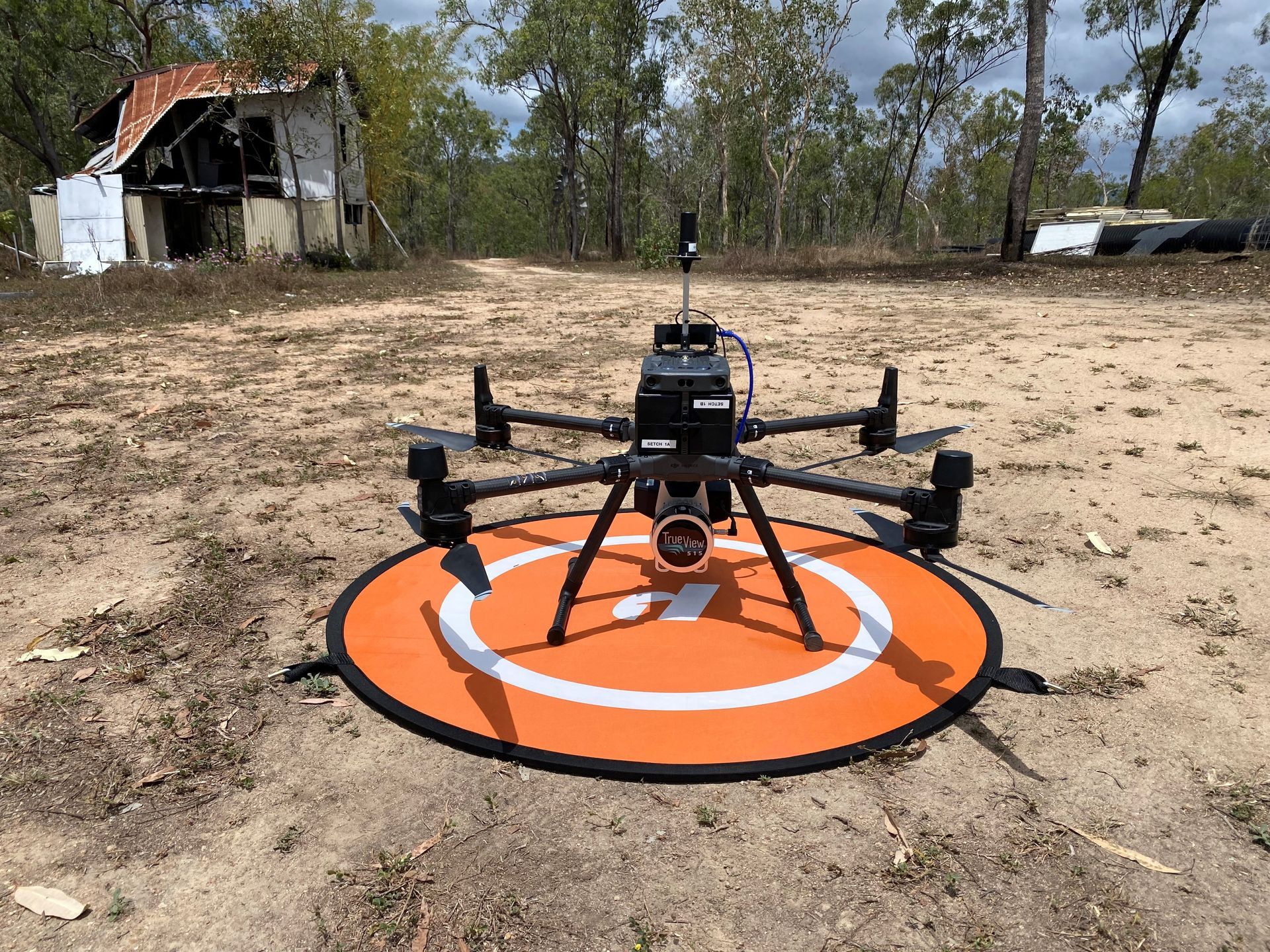
We deploy cutting-edge drones that guarantee rapid, precise data capture. These tools are essential for efficiently covering large areas and capturing detailed information, even in potentially hazardous environments.
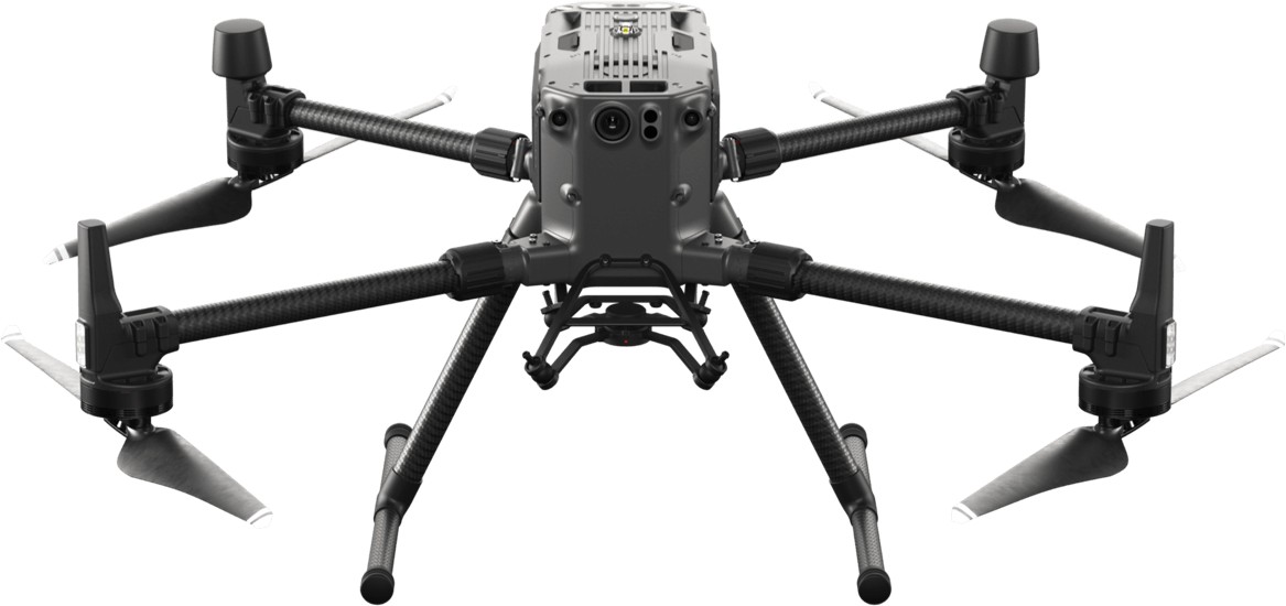
GeoCue TV515 + DJI M300
The GeoCue TV515 is a LiDAR/camera platform designed to generate high accuracy 3D colorised LiDAR point clouds. With its wide 120° field of view and fast scanning rate, the True View 515 provides 3D colour mapping with excellent coverage over multiple square kilometres. The TV515 is particularly capable in applications where penetration of dense vegetation to capture the ground below is required. Software can be used to generate ground extractions and contour maps of terrain.
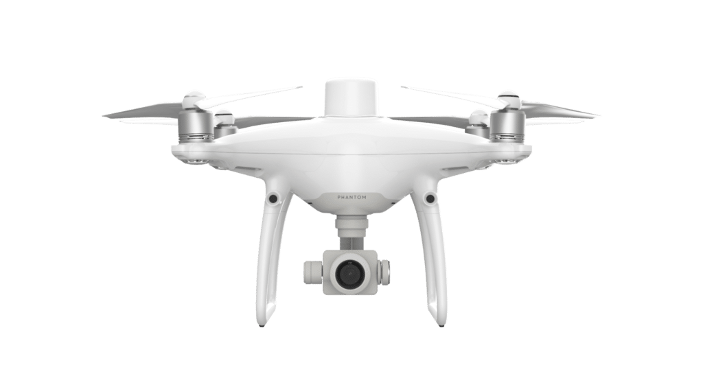
DJI Phantom 4 RTK
The DJI Phantom 4 RTK is a smaller aerial survey drone that relies on photogrammetry rather than LiDAR for reduced weight and cost, making it suitable for outdoor stock pile volumes, local terrain modelling and visual inspections. It uses a base station to provide real-time positioning data for improved accuracy on image metadata. These images can be used as is for inspections or processed through photogrammetry software to produce georeferenced orthomosaics, 3D point cloud, meshes and contour maps.
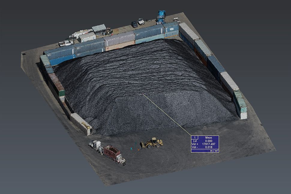
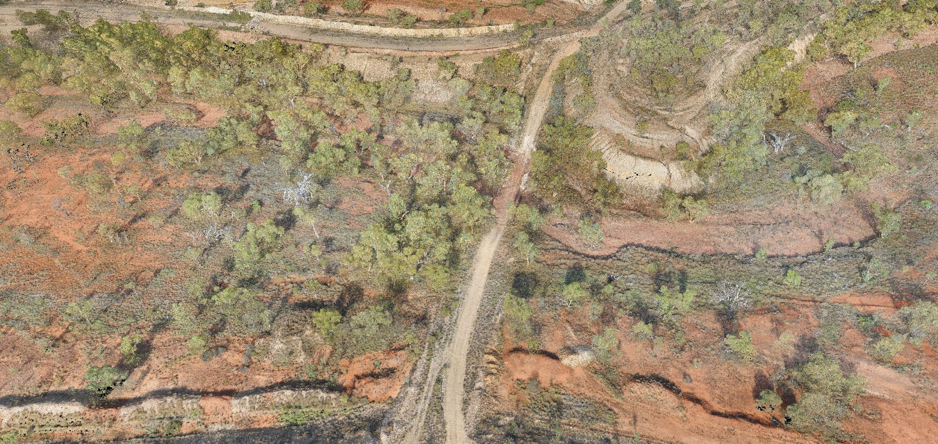
Aerial LiDAR and Mapping Examples
The Advantages of Aerial Mapping
Choosing Setch Design for aerial LiDAR and mapping has numerous benefits. Our drone technology allows for rapid data capture across large areas, ensuring cost-effectiveness and high-detail reliability. It’s also a safer alternative for capturing potentially hazardous locations. Additionally, our technology enables accurate monitoring of changes over time, providing valuable insights for project planning and execution.
Elevate your projects with
Setch
Design’s aerial surveying and mapping services in Townsville, QLD.
Contact us at (07) 4725 3544 for efficient and convenient aerial data capture.